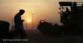
Opinion: Governments need satellite data to tackle climate-related food insecurity


One of the quiet data revolutions that has been happening over the last few years has been an explosion in the availability of Earth observation, or EO, data — images from satellites in the sky as well as sensors collecting information on air quality, soil composition, ocean currents, and seismic activity.
This provides a whole new way of looking at the world — as well as numbers in a table, this data offers a 3D view of the state of the Earth, in close to real-time, unlike any that we have been able to see before.
We are just beginning to understand what can be done with this new source of information, and together with our partners at NASA, Group on Earth Observations, and Committee on Earth Observation Satellites, we are responding to a common need for EO data to support decision-making across the Sustainable Development Goals. However, some of the most promising innovations have been in a sector long underserved by traditional data collection — the critical business of agriculture and nutrition.
See more Satellites for Sustainability stories:
► Taking a space-age approach to food security
► Making satellite technologies work for sustainable development
► Opinion: Mapping out the future of humanitarian response
► How GIS can help us understand our changing oceans
► Opinion: Transforming aid and development with satellite imagery
When working with governments, the private sector, and civil society, the lack of basic information needed for sustainable food production comes up again and again as an issue limiting progress. Without up-to-date information on what is being planted when, on changing weather conditions, on water availability, and soil conditions, it is harder for both farmers and for governments to make the right decisions about agriculture — a sector that is critical for family incomes, for economic growth, and for employment generation in many countries around the world. EO data is an indispensable source of information filling this gap, while also benefiting other related areas such as deforestation, urbanization, and flood mapping.
Using satellite and other EO data, insights can be extracted. Governments and others can use it to calculate the total acreage of agricultural land under cultivation, identify crop types, soil moisture, water sources, and health and density of vegetation. With access to this rich information, using a combination of meteorological data and soil conditions, they can estimate potential crop yields with a relatively high level of accuracy.
Putting EO data together with other traditional datasets can inform both national development planning as well as citizen-level decision-making by smallholder farmers. For example, in partnership with Colombia’s National Statistical Office Cepei, NASA, and GEO, the Global Partnership for Sustainable Development Data developed new methods of using satellite images to calculate statistics on land cover and use. The Colombian government identified data gaps in SDG indicators, which then fed into a workshop on using EO data to fill key data gaps relevant to SDG 6 on clean water and sanitation, SDG 11 on sustainable cities and communities, and SDG 15 on life on land. By using the Google Earth engine to explore the relationship between land consumption and population growth, then using this data to calculate the relevant SDG indicator for 138 cities in Colombia, the government was able to better track and manage urban growth.
“Achieving the SDGs will require timely, disaggregated, and dynamic data that allows for effective service delivery, citizen empowerment, entrepreneurship, and innovation. And to get there, governments, the private sector, and civil society, among other actors, must work together.”
— Claire Melamed, executive director, Global Partnership for Sustainable Development DataThis work and other projects are still in progress, and in pilot phases in many other countries, but Colombia’s progress has helped illustrate what is possible. In fact, EO data can be used to contribute to over 70 different targets spanning every SDG alongside numerous SDG indicators.
A food and farming solution?
Following successful pilots, the next challenge is taking this to scale. The African Regional Data Cube, launched at the 2018 Data for Development Festival in Bristol, United Kingdom, is an innovative example of how EO, satellite data, and advanced technology can be applied for local, national, and regional solutions. The technology will allow Kenya, Senegal, Sierra Leone, Ghana, and Tanzania to better navigate the economic, social, and environmental systems on which they depend.
The ARDC is being coordinated by the Global Partnership and developed by the CEOS in partnership with the GEO, Amazon Web Services, and Strathmore University in Kenya.
Vast quantities of freely available and timely satellite data offer a real opportunity to grow smarter, waste less, and to innovate for efficient, effective production. But the burden of satellite data management and analysis has been a barrier to success, with developing countries generally lacking capacity to use this data to assess local resources, land and water, and monitor agriculture production and land change.
ARDC will provide important solutions to government ministries, national statistical agencies, geographic institutes, research scientists, civil society, and beyond. It will allow users in the region to apply satellite-based EO data to address local and national needs and development strategies, meet international initiatives such as the 2030 Sustainable Development Agenda, and support the upcoming 2020 round of censuses in African countries — the most significant data collection exercise for a decade.
Satellites for sustainability are part of a bigger process
Supporting the use of EO data for sustainability is just part of the work we do with governments to develop data ecosystems at the global, national, and local level. Working with Colombia, Ghana, Kenya, the Philippines, Senegal, Sierra Leone, and Tanzania on the data roadmaps for sustainable development process, we aim to better understand the challenges and opportunities related to the production and use of data to achieve sustainable development, and build the relationships, institutional frameworks, and “data cultures” necessary to drive progress. Achieving the SDGs will require timely, disaggregated, and dynamic data that allows for effective service delivery, citizen empowerment, entrepreneurship, and innovation. But to get there, governments, the private sector, and civil society, among other actors, must work together.
While this may sound simple, implementing a multistakeholder approach, in which various data communities collaborate to solve key challenges, is often difficult given politics, institutional arrangements, and resource and capacity constraints. This is why events like the Data for Development Festival where partners can share achievements, such as the ARDC, and collaborate for impact and scale, are critical components in facilitating a collaborative approach in working towards improving the lives of millions of people.
Read more about the impact of satellites in development work on our Satellites for Sustainability site.
About the author

Claire Melamed@clairemelamed
Claire Melamed is the CEO of the Global Partnership for Sustainable Development Data. She was previously managing director of the Overseas Development Institute, and has worked in the Office of the United Nations Secretary-General and for a number of NGOs. Claire is an affiliated researcher at the Bennett Institute for Public Policy at the University of Cambridge and serves on the boards of Full Fact and Our World in Data. She is also the vice-chair of the U.N.’s Multi-Stakeholder Working Group on Data Governance at All Levels.
Search for articles


Most Read
- 1
- 2
- 3
- 4
- 5