
MANILA — One Saturday in January, an ash eruption from Mount Mayon Volcano, in the Philippines, sent provincial disaster officials scrambling to evacuate residents within the 6-kilometer radius of the permanent danger zone. Within weeks, after Mayon spewed an ash column 5 km high, officials placed the entire province under a heightened alert, warning of an imminent hazardous eruption. School and work were suspended, air travel was canceled, and the ash destroyed an estimated $3 million worth of agricultural crops.
Three months on, and the Philippine government continues to execute a massive relief effort that requires moving nearby residents to safety, temporarily resettling them in evacuation centers, and providing the food and nonfood items they need to survive. Various national and local agencies and stakeholders are involved in these efforts, including the Office of Civil Defense, which oversees the Mayon operation; the Department of Social Welfare and Development, which leads the disaster relief response and the monitoring of evacuation centers; and the Department of Public Works and Highways, which monitors road networks and river channels, and supervises the construction of facilities in evacuation centers.
“Disaster response is not just one agency; it’s a team effort,” said Arnel Garcia, the regional director of DSWD. “There is a coordinated and synchronized response, even with the local government.”
This multiagency approach presents both opportunities for a more robust response and challenges in terms of coordination and collaboration.
In comparison with previous relief efforts, Philippine government officials, emergency responders, and aid workers today are witnessing substantial progress. Among the improvements are more versatile and reliable satellite communications systems, which have played a critical role in the orderly evacuations of more than 60,000 people and supporting social systems that deliver crucial aid and relief.
Learning from experience
This is not Albay’s first disaster or sustained relief effort. In 2006, Typhoon Durian struck the Philippines with a force equivalent to a Category 4 hurricane. Known locally in the Philippines as Typhoon Reming, the tropical cyclone swept across the island nation, affecting 3.5 million people and causing extensive damage to schools, homes, and personal property. As is often the case in the Philippines, poor rural communities and farmers were among those most devastated and suffered dramatic losses of their crops, livestock, and livelihoods.
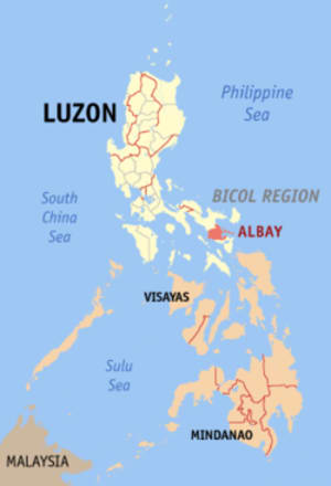
The Bicol region and southern Luzon province of Albay was by far the hardest hit. Home to Mayon, which had emitted a fresh layer of ash soon before Durian made landfall, the storm’s intense rainfall triggered mudflows from the lahar deposits that formed along the volcano’s slopes — burying surrounding villages and killing over 600 residents.
The magnitude of devastation caused by Durian was a turning point for Albay residents and government officials, offering an opportunity to reassess the area’s vulnerability and rethink emergency preparedness and response. Under the leadership of former Albay Governor Joey Salceda — now serving as an Albay congressman and widely regarded as a champion of disaster risk reduction and management, or DRRM — the province pledged to concentrate resources on disaster preparedness, improve disaster communications, and implement a zero-casualty program. Various evaluations carried out after Typhoon Durian exposed that breakdowns in communications systems and protocols severely hampered response efforts and activities.
“There was no service for several months,” said Claudio Yucot, regional director of the Office of Civil Defense, referring to the damage caused by the tropical cyclone. “We cannot perform our duties if we do not have communication.”
Still today, the entire archipelago of the Philippines suffers from unreliable telecommunications and internet infrastructure. Internet speed is well below global averages. Akamai Intelligent Platform, in their State of the Internet Report, even indicates that the Philippines has the lowest average internet connection speed in the world. These realities can obstruct emergency communications and DRRM during all phases of a natural disaster.
Making informed decisions
Additional factors inhibit the emergency response to Mayon activity. Among the most difficult are the sheer breadth and unique geography of the disaster zone — which comprises six municipalities and three cities that circle the entire base of the volcano — as well as pervasive poverty across the region.
Complicating matters, many of the local residents refuse to relocate from their homes and lands because volcanoes produce fertile soil that is easier to farm.
Geography matters
Situated along the Pacific Ring of Fire, the Pacific Typhoon Belt, and the eastern seaboard of the Philippines, Albay Province, located in the Bicol region, is highly vulnerable to both geologic and meteorological hazards. On average, 20 typhoons strike the country each year and Mayon, one of the world’s most active volcanoes, erupts approximately every four years.
“The Bicol region is also home to the second largest number of poor families and beneficiaries of the conditional cash transfers,” Garcia added, referring to a national social protection program that targets only the poorest communities in the Philippines.
When Mayon began to erupt earlier this year, government officials realized the situation would require a sustained relief effort. Officials identified the need for a dependable communications system that would allow them to understand what is happening across the affected areas and make informed decisions on what actions to take.
They activated the Incident Management Team, a rapid response team led by the Office of Civil Defense and composed of various government agencies. Referencing plans and protocols from previous years, the IMT prioritized the evacuation and relocation of residents at the foot of the volcano and then moved on to setting up the evacuation centers.
To assist with this effort, the IMT also established an incident command center, which would serve as the central coordination hub for all Mayon evacuation and response operations, information gathering and dissemination, and coordination with local governments, outside aid, and volunteer organizations. According to government officials, there was limited space availability in Legazpi City — the capital of Albay Province — and virtually no locations equipped with the connectivity necessary to operate effectively.
“Initially, our problem was the internet access. We could not get sufficient signal required for the operation,” the Office of Civil Defense’s Yucot told Devex. “When DSWD offered to use the satellite communication system, we used it right away.”
For the last several months, DSWD has been working with commercial satellite provider Inmarsat to adopt and institutionalize a satellite communications system known as Global Xpress, or GX. Last year, DSWD officials carried out formal testing exercises in Manila and, following preparations and staff training, it was quickly deployed when Mayon erupted. The Inmarsat technology is now prepositioned in different hazard-prone areas across the country as part of a long-term international partnership program supported by the UK Space Agency.
“It is not intimidating to use,” said DSWD regional planning officer and technology unit head Joseph Teston, who managed the GX installation and continues to oversee its deployment. “We can make spot decisions based on real-time situational awareness from the ground. Information is key, and it guides us on what to do next.”
The terminal was deployed on the rooftop of a hospital in Legazpi City, where Dr. Eric Raborar simultaneously serves as Mayon incident commander and chief doctor. He compares it to the system in an intensive care unit of a hospital wherein messenger groups function as monitors that allow responders to know exactly what is happening to the patients. Based on information exchanges between evacuation centers in the field, the command center, and official in Manila, they can accurately diagnose the situation and prescribe the right remedy or course of action.
Embracing technology solutions for future response
Currently, the GX powers at least 25 computers in the command center at one time. The center receives over 150 messages a day from across 59 evacuation centers. With the widespread use of Facebook in the country, the team employed Facebook Messenger to facilitate live feeds from evacuation centers to decision-makers in the command center and to regional and Manila offices. Through the social media platform, the IMT created a three-tier communication system: In Tier 1 a camp manager provides updates; Tier 2 processes and verifies the information; and Tier 3 classifies and forwards the information. The various government agencies and personnel receive the advisories, complaints, and incident reports within minutes.
“It responds to the needs of Albay’s massive evacuation effort [and] provides the speed that allows us to upload and download and share voluminous data across agencies,” said Yucot. “I don’t have a problem with speed because instantly I get the information. As a government decision-maker, that is very important.”
Yet many of the evacuation centers in the region remain isolated, out of reach, and offline. To connect them to the network, Inmarsat also provided small and lightweight BGAN portable satellite terminals that facilitate voice and broadband data communications in remote areas. DSWD routinely visits these offline centers with the BGAN so camp managers can send their situation and incident reports to the command center.
“Before, we were always late in [submitting daily reports] because we had to wait for someone to go to town and access the internet,” said Gemma Requinala, who administers the Bubulusan Evacuation Center in Albay.
By closely monitoring camp activities through online channels, response teams can make the necessary adjustments to improve operations. For example, when evacuation centers located along the national road or main highway receive excess donations compared to evacuation centers in remote areas, DSWD immediately redirects the flow of goods to balance out the support. The online channels also help ensure that accurate information is shared with the public. When a major news outlet reported that expired relief goods were distributed to Mayon evacuees, the response team immediately reviewed the information, confirmed it was inaccurate, and released a statement contesting it. Success stories such as these are helping the government embrace technology solutions to DRRM.
Evacuees are also seeing the benefits. According to evacuation center managers, they typically receive support within 24 hours of posting incidents in the messenger channel. When one camp manager reported a lack of toilet facilities, their center received four portable toilets from the public works department the following day. Because all government agencies are members of the channel, camp managers are confident that the information they report gets directed to the right agency.
“The technology facilitates the synchronization of activities across evacuation camps and report immediate concerns that need action by regional and national agencies,” said Garcia.
The satellites also help evacuees stay informed of current and upcoming initiatives in the camp, allowing them to organize their schedule ahead and how they can participate. When DSWD implemented the CASH-for-Work Program for example — a short-term intervention to provide temporary employment to displaced individuals — they were then able to plan ahead.
Most Albay residents have accepted typhoons and Mount Mayon’s periodic eruptions as part of their lives. But the improved government response provides evacuees security and comfort until they are able to return to their own homes. With their basic needs met, evacuees are less inclined to return back to their homes and farms before given the all-clear, and risk their lives.
“The only way to adjust is to come up with newer technologies that will facilitate our intervention programs for the poor and for the disaster-prone communities,” said Garcia. “I recommend this not only for the other regions, but to other countries as well. And given that Bicol is a model for disaster operations, take it from us.”
About the author

Devex Editor
Thanks for reading and for your interest in Devex. Sponsored content is produced in collaboration between Devex’s partnerships editorial team and our partners to promote a partner’s work or perspective on a particular issue. It gives actors across the global development sector — including nongovernmental organizations, private sector stakeholders, aid agencies and government institutions — the opportunity to go beyond traditional advertising and tell their stories in an impactful way. If you'd like to learn more about how you can shine a spotlight on a particular issue with Devex, please email advertising@devex.com. We look forward to hearing from you.
Search for articles
Most Read
- 1
- 2
- 3
- 4
- 5