


SAN FRANCISCO — The COVID-19 pandemic has led to a surge of interest in satellite imagery to track changes on the ground from a distance.
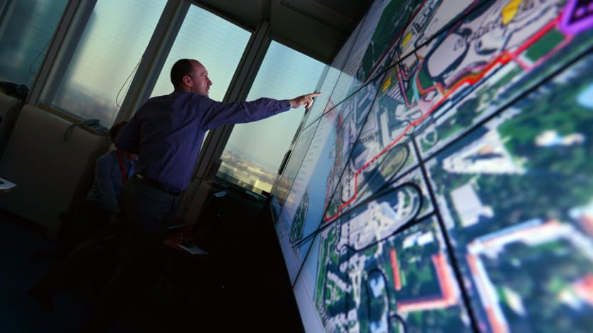
Planet, a San Francisco-based company that offers daily imagery and insights from a network of miniature satellites, has seen a dramatic increase in demand for its tools and technologies this year. Many organizations that cannot do their normal site visits due to lockdowns have opted for satellite images as alternatives, Will Marshall, CEO of Planet, said during his opening keynote at the company’s virtual user conference. He said he expects some of these to become permanent changes in behavior as users see the efficacy of Planet’s satellite data.
Satellite imagery captures conditions on the ground, from agricultural yields to rates of urbanization, and informs what actions can be taken to improve them. Geospatial data has been applied to the COVID-19 pandemic, for example in monitoring where the coronavirus is most likely to emerge. These insights from space will be critical to data-driven decision-making in support of the Sustainable Development Goals.
“This is an age of possibility in the midst of a crisis,” Achim Steiner, administrator of the United Nations Development Programme, said during the Planet event. “Through the eyes of a satellite, just like the Apollo image of Earth, we suddenly enter a different state of consciousness, knowledge, and therefore valuation of what it is that is of consequence in what we do.”
And as the frequency, amount, and quality of satellite imagery improves, new opportunities are emerging to protect biodiversity, deliver public health, and measure progress on the Sustainable Development Goals.
Monitoring and protecting nature
Opinion: Satellite imagery — global data for global goals
The global coverage of satellite imagery is a perfect tool to support the Sustainable Development Goals. UNITAR’s Nikhil Seth explains how this can be done in practice.
The pace and scale of the impact that humanity has had on the planet is hard for people to wrap their heads around, said Andrew Zolli, who oversees global impact initiatives at Planet.
“How do we take these problems from the realm of abstractions down to the level where they can be understood and acted upon in ways that are not just the domain of elites and institutions but the responsibility and opportunity of every person?” Zolli said.
In September, Planet was selected for a contract with Norway’s Ministry of Climate and Environment to produce universal access to satellite monitoring of tropical forests. The organizations involved in the partnership are making the data available as a digital public good as part of an effort to combat deforestation. But a key question facing donors, NGOs, and tech companies is how to ensure the power of these satellite technologies is broadly accessible.
Speakers during the Planet event said progress has been made in closing the gap in access to information between people on the front lines and leaders in the halls of government.
“I think what we’re going through now is a revolution in the scalability of our understanding between what decision-makers might hear and what stakeholders on the ground or on the sea might be dealing with,” said Greg Asner, director of Arizona State University’s Center for Global Discovery and Conservation Science, who spoke about the role that satellite imagery plays in his efforts to map and monitor the world’s coral reefs.
But he and his fellow panelists agreed that while information is more actionable when it captures destruction in real time, enforcement has not kept up with the advancements in monitoring biodiversity loss.
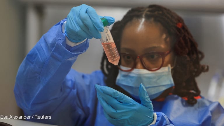
Delivering precision public health
The END Fund, a philanthropic organization working to eliminate neglected tropical diseases, is in conversation with Planet about ways that geospatial data can help make smarter programmatic decisions.
The images could help the organization track the movement of NTD-infected populations, identify breeding sites for insects that carry these diseases, and generate real-time insights on mass drug administrations, said Jamie Tallant, associate vice president of programs at The END Fund.
“Through the eyes of a satellite … we suddenly enter a different state of consciousness, knowledge, and therefore valuation of what it is that is of consequence in what we do.”
— Achim Steiner, administrator, United Nations Development ProgrammeCurrently, by the time The END Fund does a coverage survey for a mass drug administration, it is too late to go back and distribute more medicines; real-time data would allow these efforts to be cheaper and more effective.
From neglected tropical diseases to malaria to vaccine-preventable diseases, lifesaving health interventions are not getting to everyone who needs them, said Anna Winters, CEO of Akros, an organization that designs and implements health information systems.
“Field teams are really lacking the information that they need,” she said. “They can oftentimes be operating blindly.”
Based in Zambia, Akros uses satellite imagery to map populations and get that data in the hands of community health workers and others who can put it to use.
The organization developed an open-source platform called Reveal to help fieldworkers use spatial intelligence to deliver interventions to people who might otherwise be missed. The technology has primarily been used for indoor residual spraying to reduce malaria transmission. With Reveal, Akros is helping fieldworkers navigate communities, prioritize households, and collect intervention data on mobile devices.
Real-time geospatial data, epidemiological models, and work in the field are the “three elements that need to come together in order to deliver precision public health,“ Zolli of Planet said.
Over the course of the COVID-19 pandemic, Planet has been inundated with requests to inform precision public health, which Zolli described as getting the right intervention to the right place in the right moment and as being efficient with resources.
This precision public health approach will be necessary to shorten the time from the availability of the COVID-19 vaccine to its delivery to populations of highest need, he added.
Measuring development progress
Since the COVID-19 pandemic began, 96% of national statistical offices have fully or partially stopped face-to-face data collection, according to a 2020 report from the United Nations Department of Economic and Social Affairs.
How mapping skills can drive progress on the SDGs
Geospatial data has become more widely available, but new tools to turn real-time data into insight and action often launch without the training to help make sense of and act on data. SDGs Today is providing real-time data to bridge that gap.
“COVID has halted the collection of data around the world for many national governments,” said Marshall Burke, an associate professor at Stanford University and co-founder of Atlas AI, a technology startup that combines satellite imagery with artificial intelligence to develop agricultural and economic insights.
He presented the United Nations data, which also noted that 9 in 10 national statistical offices in low- and lower-middle-income countries reported the pandemic had an impact on their ability to meet international reporting requirements.
While measurement from the ground faces many challenges, it remains critical, Burke said.
This information can be combined with the wealth of satellite data now available, and insights from artificial intelligence, to measure the intersectionality of issues and ask questions like “How does improving agricultural productivity affect livelihoods?”
Burke called the lack of high-quality ground data the biggest constraint that researchers face in training and validating artificial intelligence and machine-learning models.
Vivien Foster, chief economist for the Infrastructure Vice-Presidency at the World Bank, emphasized the importance of partnerships to get this kind of data into the hands of people who can act on it.
“These days, any data exists somewhere,” she said. “Somebody has it and the question is simply: Who has access to it, and how, and on what terms?”
Foster acknowledged that some countries do not collect data, and this is often in fragile states, which are increasingly a focus of the World Bank’s work.
But if the World Bank can use existing data to train algorithms, it can extrapolate to countries “where the data is absent,” she said.
Visit the Data for Development series for more coverage on practical ways that satellite data can be harnessed to support the work of development professionals and aid workers. You can join the conversation using the hashtag #DataForDev.
About the author

Catherine Cheneycatherinecheney
Catherine Cheney is the Senior Editor for Special Coverage at Devex. She leads the editorial vision of Devex’s news events and editorial coverage of key moments on the global development calendar. Catherine joined Devex as a reporter, focusing on technology and innovation in making progress on the Sustainable Development Goals. Prior to joining Devex, Catherine earned her bachelor’s and master’s degrees from Yale University, and worked as a web producer for POLITICO, a reporter for World Politics Review, and special projects editor at NationSwell. She has reported domestically and internationally for outlets including The Atlantic and the Washington Post. Catherine also works for the Solutions Journalism Network, a non profit organization that supports journalists and news organizations to report on responses to problems.
Search for articles


Most Read
- 1
- 2
- 3
- 4
- 5