GIS for SDGs: 'See things that were impossible to see,' Esri founder says


SAN DIEGO, Calif. — Jack Dangermond, founder and president of Esri, selected the location for every tree at the headquarters of the geographic information systems software company in Redlands, California.
Dangermond was trained as a landscape architect, and he is committed to advancing the practice of geodesign, or using geographic knowledge to design with nature in mind. When he and his wife Laura founded the Environmental Systems Research Institute 50 years ago, the focus was on land use analysis. Now, as their GIS software products and services are being used across industries, Dangermond continues to highlight the way GIS can help the world transition from exploitation to conservation.
“Geography isn’t just about maps — it’s about intellectually connecting things that did not initially appear connected.”
— Andrew Schroeder, director of research and analysis, Direct ReliefEsri offers its software at a discounted rate to NGOs, and many of these organizations were onsite at the Esri user conference in San Diego this week.
“The development community can see things that were impossible to see through digital geography,” Dangermond told Devex.
He and several NGO leaders highlighted steps the global development community can take to better leverage GIS in their work.
1. Gather geographic information
Property rights has three components — who, what, and where, said Frank Pichel, chief program officer at Cadasta. The NGO uses ArcGIS, Esri’s mapping and spatial analytics software platform, in its work to advance land and resource rights.
Meet a technologist building digital data systems for dirt
William Wu, co-founder and CEO of QED, speaks with Devex about his work with the African Soil Information Service and other international development projects that require data systems and machine learning solutions.
The first step Cadasta takes in the communities it supports is to gather all information that has to do with where, then build systems of recordkeeping about that geographic information.
“Virtually anything you see when you look out a window that can be put into a database which is spatial,” Dangermond said.
It is becoming easier to take in geographic data, but now the key is to capture, organize, and manage it in order to use it to improve decision-making, he said.
2. Visualize the data
The theme of the Esri user conference this year was “See what others can’t.”
Esri offers tools and services that help organizations, including NGOs, that get their products at a discount, to gain new perspectives on the data they collect.
People trivialize the work of GIS experts, by seeing it simply as mapping, Dangermond said.
But what Esri’s ArcGIS software allows users to do is visualize databases of every type.
“Once you georeference the information in your database, then you can visualize that data in the form of maps,” he said.
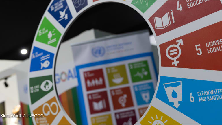
An example of this is a data hub for the Sustainable Development Goals resulting from a partnership between Esri and the United Nations. The goal is to help member states measure and report their progress on the SDGs, said Stefan Schweinfest, director of the U.N. Statistics Division.
He told Devex the U.N. wants to see more countries strengthening their geospatial capability, in part so they can track and also accelerate their work on goals that can be mapped out visually.
3. Conduct spatial analysis
Conducting spatial analysis means overlaying maps and evaluating relationships between them, Dangermond said.
At the Esri user conference, he introduced Ambassador Stefano Toscano, director of the Geneva International Centre for Humanitarian Demining, who gave a talk on the role spatial analysis plays in removing mines and returning the land to the community.
Dangermond explained to Devex how valuable spatial analysis can be in determining the cause and effect of a particular phenomenon, whether in agriculture, global health, or conservation.
4. Create geographic plans
At Catholic Relief Services, geographic plans might include where to place water harvesting structures, said Adam Keough, knowledge manager for landscapes and water restoration.
In El Salvador, CRS uses GIS in its work to restore an area where poor soil health makes it difficult for farmers to grow enough food, he said.
How family planning can help save cheetahs
Conservationists and reproductive health actors may seem unlikely partners, yet two organizations have teamed up to publish a policy paper advocating for joint work on cheetah conservation and family planning.
Keough said representatives from CRS are at the Esri user conference this week to figure out ways to involve local communities at every level, from defining what the data needs are, to collection, to turning over tools to local actors and allowing them to take over.
Geographic plans help organizations decide what to do where, Dangermond said.
“So when we look at Starbucks, why are they doing all this analytics of demographics? So they can pick a better place for their store to be successful,” he explained.
The NGOs joining corporations at the Esri user conference tend to be ahead of their peers in the use of spatial data. But most NGOs still “see GIS as a project related tool,” said Peter Rabley, venture partner at Omidyar Network.
The dynamic tends to be GIS teams working on the side versus GIS being part of a central strategy of the organization — and Rabley sees this as something that needs to change.
5. Take action
When Andrew Schroeder, director of research and analysis at Direct Relief, talks about the value of GIS, he tries to emphasize that it’s about more than technology.
“When you do GIS well and all the time, you start to see that geography isn’t just about maps — it’s about intellectually connecting things that did not initially appear connected,” he said. “It changes the questions you ask, how you look at the world, and the problems you’re trying to solve.”
Schroeder said that while anyone can make maps, the key is to build integrated GIS systems, or workflows based on spatial information.
Dangermond calls geography “the science of our world.” It helps people to see relationships and complexity and patterns, then map out different possibilities, weighing the benefits and risk of each in order to make the best possible decision, he said.
But after sensing through measurements, seeing through visualization and mapping, and modeling relationships and making projections, the next step is to take action.
“The science of where, which is basically digital geography and GIS, provides us with a framework and process similar to our brains,” he said at the Esri user conference. “We sense, we understand, and we respond.”
About the author

Catherine Cheneycatherinecheney
Catherine Cheney is the Senior Editor for Special Coverage at Devex. She leads the editorial vision of Devex’s news events and editorial coverage of key moments on the global development calendar. Catherine joined Devex as a reporter, focusing on technology and innovation in making progress on the Sustainable Development Goals. Prior to joining Devex, Catherine earned her bachelor’s and master’s degrees from Yale University, and worked as a web producer for POLITICO, a reporter for World Politics Review, and special projects editor at NationSwell. She has reported domestically and internationally for outlets including The Atlantic and the Washington Post. Catherine also works for the Solutions Journalism Network, a non profit organization that supports journalists and news organizations to report on responses to problems.
Search for articles


Most Read
- 1
- 2
- 3
- 4
- 5