How GIS technology could help your NGO
Devex looks at how NGOs are using data-driven mapping technology around the world to support the Sustainable Development Goals.
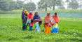
When pregnant and nursing women walk five to six hours for food distribution, the journey to the site and back can be such a drain on their energy that it defeats the purpose of those nutrients. In Madagascar, the humanitarian organization Catholic Relief Services is using spatial systems for topographical analyses to reduce travel times for these women, by determining which distribution sites capture the most beneficiaries within the smallest radius. Geographic information systems, or GIS, merge cartography, spatial analysis, and database technology. This software can help organizations in the global development and humanitarian response sector with needs ranging from program site selection to monitoring and evaluation, and data management. For example, NGOs can combine historical country program data with existing data on the location of vulnerable populations to target those areas that are most in need. The Sustainable Development Goals were on the agenda at the Esri user conference held in San Diego, California, earlier this month. Esri is a company focused on problem solving with GIS, and is working with a growing number of organizations in the nonprofit sector. The company is behind ArcGIS, a cloud-based mapping platform that makes up the dominant share of the GIS software market, but other GIS developers are increasingly able to offer their services to NGOs as the cost of software and need for specialized skills decreases over time. “GIS provides us not simply a language, but it provides us a fundamental framework, wherein we can organize our maps and our data, we can integrate it, we can do all the data compilation and then visualize it and analyze the relationships and patterns,” Jack Dangermond, president of Esri, said at the conference. “We can do predictive analytics. We can also do design and planning on it. We can make decisions based on it and take those into action.” Esri is now calling the field of GIS “The Science of Where.” With these words the company aims to capture how a smart use of data analytics — or managing, analyzing, and applying geographic information — can help decision makers solve problems including the SDGs more effectively. This new tagline might help GIS professionals convey that they are more than just map guys, while also bringing new users on board, as they better understand how GIS can inform their decisions. “It’s really a new way of describing the collective work done by the GIS community,” said Charles Brigham, who worked for organizations including the World Bank, the United Nations and NASA before joining Esri to build ties with the nonprofit sector. “It’s applying a data driven approach that uses geography to expand understanding.” Earlier this month, Esri and Microsoft announced new grants for organizations that could benefit from Esri’s GIS software and Microsoft’s cloud and artificial intelligence tools by enhancing land cover mapping to accelerate conservation, in a partnership Esri said is putting “the Science of Where” vision in motion. For Joshua Poole, the CRS country representative for Madagascar, the impact Esri technology had on reducing walking distances for pregnant mothers convinced him of the value of GIS. “Organizations need to be able to explain to people what the impacts are, especially to donors, who need to buy in and there is usually a price tag,” he said. “They also have to understand the systems that need to be in place, the devices that need to be invested in, the training that needs to happen for staff — but the impact you can have is incredible.” Poole said the investment CRS has made in GIS varies country by country, but that the United States Agency for International Development has invited the Madagascar team to present on their approach to other implementers. The charity uses maps not only to see where needs are, but also to enable collaboration with local beneficiaries and international partners, according to a report. In The Gambia, CRS has used GIS to analyze the relationship between the national population and the distribution of insecticidal nets for prevention of malaria. Layering data such as district populations and distribution sites has helped project teams determine which areas received too many or too few nets. With GIS, they could adjust their plans and improve their bednet distribution efforts. When Typhoon Haiyan struck the Philippines, CRS used drones in its emergency response planning, capturing new aerial imagery and comparing this with older images to understand the levels of damage. Local residents then brought context to those preliminary maps with participatory, or community-based, mapping. And in Lesotho, CRS analyzed satellite imagery to compare images from the early planting of crops with post harvest, to help farmers incorporate drought tolerant crops. The World Health Organization is also leveraging GIS technology. The Global Polio Eradication Initiative reached out to Esri’s disaster response program to build an app that could highlight areas in need of vaccinations. The technology has enabled WHO to get field workers to recent polio outbreaks in the Democratic Republic of Congo faster. “The GPEI is always looking at new innovations and working with new partners to help sensitive polio eradication strategies,” said Oliver Rosenbauer, communications officer at WHO. “The aim is always to ensure that the maximum number of children can be reached and protected with polio vaccine. GIS and similar technologies can help further identify where children may be missed, and its use can help strengthen operations. Initial outcomes of this application are very encouraging and other opportunities could be explored on how such innovations can address broader public health issues, not just on polio eradication but [also] other diseases of public health importance.” GIS is changing rapidly, from new data sources such as drones, to constantly improving infrastructure such as machine learning. Cheaper devices and open source tools including Google Earth, QGIS, OpenStreetMap are making GIS technology more accessible. There are a growing number of users, tools and applications for GIS, giving way to a growing number of opportunities for GIS to advance the SDGs. “It provides a set of objectives that many organizations can get aligned behind, and we can all work toward the same set of goals with the same set of indicators building content in common ways,” Clint Brown, director of product engineering at Esri, said in a recent webinar about using “The Science of Where” for sustainable development. Whether or not GIS users are working on the SDGs directly, the goals present an opportunity for them to contribute information to support the SDG indicators. At the Esri user conference, the United Nations Statistics Division said it plans to integrate the global SDG indicator database with geospatial analysis and visualization tools, as well as to support member states in conducting pilot projects to integrate geospatial information into national SDG indicator frameworks. GIS would also bring small area detail to assessments of SDG progress. Because there are no international agreements to guide national statistics offices on how to define urban or rural spaces, the collection of location based data would help to ensure that communities do not fall through the cracks of the SDG indicators. Read more international development news online, and subscribe to The Development Newswire to receive the latest from the world’s leading donors and decision-makers — emailed to you free every business day.
When pregnant and nursing women walk five to six hours for food distribution, the journey to the site and back can be such a drain on their energy that it defeats the purpose of those nutrients. In Madagascar, the humanitarian organization Catholic Relief Services is using spatial systems for topographical analyses to reduce travel times for these women, by determining which distribution sites capture the most beneficiaries within the smallest radius.
Geographic information systems, or GIS, merge cartography, spatial analysis, and database technology. This software can help organizations in the global development and humanitarian response sector with needs ranging from program site selection to monitoring and evaluation, and data management. For example, NGOs can combine historical country program data with existing data on the location of vulnerable populations to target those areas that are most in need.
The Sustainable Development Goals were on the agenda at the Esri user conference held in San Diego, California, earlier this month. Esri is a company focused on problem solving with GIS, and is working with a growing number of organizations in the nonprofit sector. The company is behind ArcGIS, a cloud-based mapping platform that makes up the dominant share of the GIS software market, but other GIS developers are increasingly able to offer their services to NGOs as the cost of software and need for specialized skills decreases over time.
This story is forDevex Promembers
Unlock this story now with a 15-day free trial of Devex Pro.
With a Devex Pro subscription you'll get access to deeper analysis and exclusive insights from our reporters and analysts.
Start my free trialRequest a group subscription Printing articles to share with others is a breach of our terms and conditions and copyright policy. Please use the sharing options on the left side of the article. Devex Pro members may share up to 10 articles per month using the Pro share tool ( ).
Catherine Cheney is the Senior Editor for Special Coverage at Devex. She leads the editorial vision of Devex’s news events and editorial coverage of key moments on the global development calendar. Catherine joined Devex as a reporter, focusing on technology and innovation in making progress on the Sustainable Development Goals. Prior to joining Devex, Catherine earned her bachelor’s and master’s degrees from Yale University, and worked as a web producer for POLITICO, a reporter for World Politics Review, and special projects editor at NationSwell. She has reported domestically and internationally for outlets including The Atlantic and the Washington Post. Catherine also works for the Solutions Journalism Network, a non profit organization that supports journalists and news organizations to report on responses to problems.