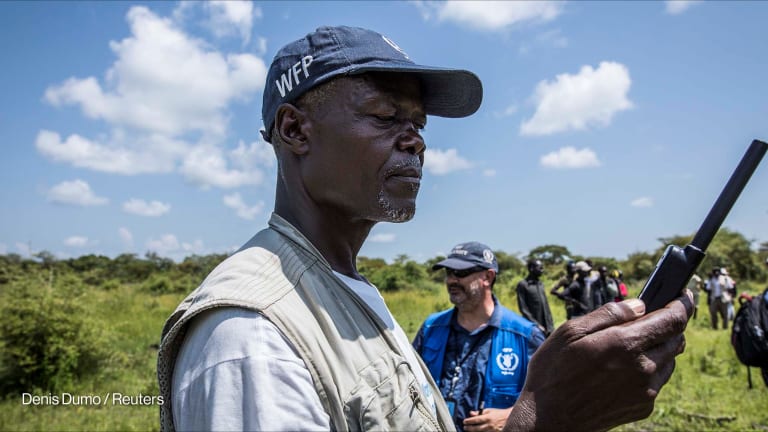


UNITED NATIONS — Last month, Belgium announced an additional €2 million ($2.33 million) to support the World Food Programme’s drone and blockchain programs. Their joint initiative to deploy drones in humanitarian crises launched in 2017, and WFP has already run a series of workshops across six different countries to better understand how the technology can be used to solve local problems.
Other aid organizations are increasingly following suit. The International Organization for Migration now uses drones to map displaced populations, Catholic Refugee Services deploys them to track coastal rebuilding, and the United Nations Children’s Fund is preparing to use them to deliver vaccines in remote areas.
“Already, because of advances in data science and AI and technology … there has been more innovation and change in the humanitarian sector in the last five years than the previous 50,” Mark Lowcock, U.N. under-secretary-general for humanitarian affairs and emergency relief coordinator, said recently at the U.N. headquarters announcement of Belgium’s new funding.
To achieve economic stability, better innovation is needed
"The Atlas of Innovation for Economic Stability" report released this week by FHI 360, with support from The Rockefeller Foundation, holds 63 examples of innovations aimed at promoting economic stability, a topic often absent from the global development dialogue.
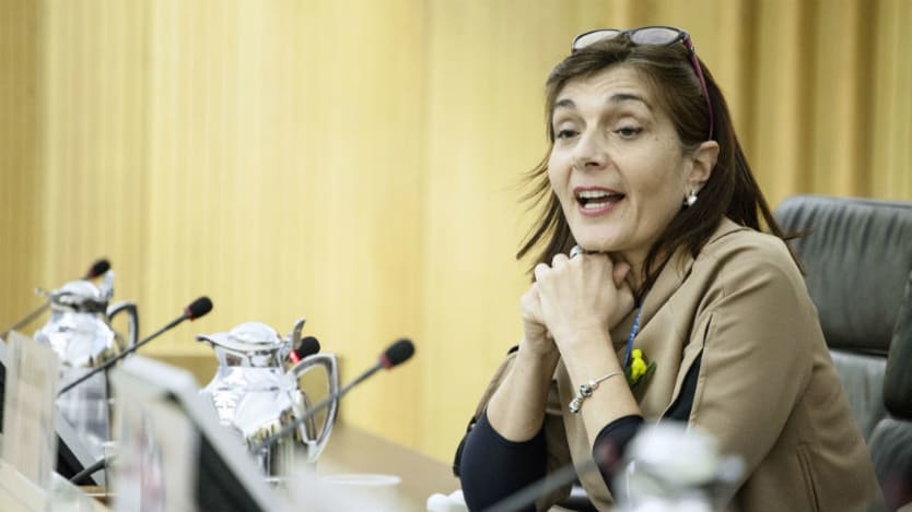
Enrica Porcari, WFP’s chief information officer and director of IT, spoke with Devex about the ways WFP and its humanitarian partners are using drones and the challenges that exist with deploying this unique technology.
The conversation has been edited for length and clarity.
What stage is WFP at right now in terms of positioning and deploying drones?
The drones have been prepositioned — we use drones in Dominica, for the Dominican response and Mozambique is another example of where we are using them — so, it is happening, it is not only a matter of planning.
Now, we are prepositioning drones in our regional bureaus to be able to deploy them for the next emergencies. WFP has approximately 37 drones located in 19 countries. These locations include both regional bureaus, where equipment and personnel are prepared to rapidly respond to sudden onset emergencies; as well as individual country offices where the equipment is utilized to support ongoing program activities, including communications, monitoring and evaluation, crop monitoring, climate change adaptation, IDP movement, and disaster risk reduction activities.
What is the benefit of using drones routinely as part of your work?
It makes the response faster. When an emergency strikes you have an undefined number of people who are affected. The real challenge of humanitarian responders is knowing where people are, how many of them there are, and where they are going. And also how badly affected the infrastructure is.
So, imagine in the case of flooding or an earthquake — drones enable you to do the vulnerability assessment in the most effective and efficient way. Access to drone technology allows us to do it cheaper than satellite imagery in order to understand the situation. It is cheaper, faster, and provides a common operating feature for the whole humanitarian community.
The real value is to have a coordinated approach to flying drones, to collecting information, to moving fast to analyze the data and the imagery that you collect. I think we have the opportunity to move this assessment of the disaster’s impacts from weeks and days to hours.
What are the challenges you see with deploying drones and making them a more routine part of WFP’s work, or work in the humanitarian sector?
One of the challenges is community engagement and acceptance on having this flying thing that at times, can be confused with the military. Having that acceptance is very important. This is why we find community trainings [two-week long training sessions with different interagency actors] very useful, because it helps make the fear that this is a military operation kind of disappear.
The second challenge is government regulations on the training. For example, you need authorization to fly, and this is why we are working with other agencies and aviation authorities both at the national, regional, and global level, to ensure we pave the way for obtaining very fast authorization.
As humanitarians it would be very frustrating if you have the wings, the people trained, machine learning, artificial intelligence — but local regulations prevent you from flying the drone. That's quite important.
The other issue is proper gas analysis, using the right amount of fuel to arrive at the destination at that specific time.
What opportunities do drones present for other humanitarian organizations outside of the U.N. system?
I wear two hats — I work for WFP, but I am also chair of the U.N.’s Emergency Telecommunications Cluster. We work on a coordinating model across all humanitarian agencies — whether U.N. agencies or NGOs — so when we do this training, we invite both local and international NGOs to participate with us, or those who could be deployed in a potential situation to work with us.
Rather than NGOs or U.N. agencies each deploying their own drone, we are looking at this as a common service to release drones in the sky because the information we need here is common.
Why fly all the drones? Instead, one agency flies it and releasing the information and provides a service for the others. This is what we are trying to do — to ensure we do not duplicate efforts without looking at the opportunity for synergies and coordination.
We are doing a lot of coordination with UNICEF, OCHA, UNDP, and with the private sector — where there is a lot of expertise about flying drones and also understanding and developing an algorithm for reading the images and making sense of them. The value is not really on flying the drone, but the data, the information you collect — how you can make better-informed decisions, and faster.
About the author

Amy Liebermanamylieberman
Amy Lieberman is the U.N. Correspondent for Devex. She covers the United Nations and reports on global development and politics. Amy previously worked as a freelance reporter, covering the environment, human rights, immigration, and health across the U.S. and in more than 10 countries, including Colombia, Mexico, Nepal, and Cambodia. Her coverage has appeared in the Guardian, the Atlantic, Slate, and the Los Angeles Times. A native New Yorker, Amy received her master’s degree in politics and government from Columbia’s School of Journalism.