WASHINGTON — Satellite data has been used for years to provide information about areas of the world that are inaccessible due to conflict, terrain, or vastness.
Now, a World Food Programme pilot project in Mali has shown that data from satellite imagery is effective as an early warning system for food security in the Sahel region, where the technology is not commonly employed.
How satellite images could improve water management in Africa
A new partnership between the International Water Management Institute and Digital Earth Africa aims to create easy-to-interpret datasets for governments and others to make more informed decisions around allocating water.
“The technology is not well understood or well known or in use in the humanitarian context, compared to East Africa or Southeast Asia and English-speaking countries,” said WFP Mali’s Laure Boudinaud. “It’s very new for the humanitarian world to use this kind satellite imagery. ... It’s a pilot, but I think it’s very promising, and we’ve received a lot of interest from other countries.”
WFP used data from Sentinel-2, an Earth observation mission operated by the European Space Agency, to examine Mopti, Mali, from July to October 2019. The region in central Mali has seen a dramatic increase in armed groups and self-defense militias over the last several years, with tens of thousands of its 3 million inhabitants internally displaced.
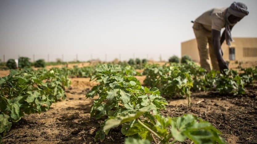
The violence further threatened already fragile food insecurity in the area that was marked by soil degradation, natural resource scarcity, and frequent drought. Instability further restricted ability to cultivate lands and reach markets.
It also left large swaths of the country inaccessible to the United Nations, nongovernmental organizations, and local authorities, restricting WFP’s ability to travel to affected regions to determine food security levels and provide needed assistance.
In place of field assessments by staff, satellites allowed WFP to track the timing and extent of planting and harvesting in 3,000 villages in a cost-effective way to see whether residents had access to their lands as needed for agricultural activities. The satellite data was cross-checked with other data sources to show that the presence of fighting often prevented successful farming.
“Of course, we triangulated the information, but we managed to establish … a clear link between conflict, agricultural activities, and food security,” said Nanthilde Kamara, emergency preparedness and response officer at WFP.
In comparing images from last year with those from a pre-conflict year like 2016 or 2017, the analysis found that 25% of localities in Mopti saw relatively less cultivated land in 2019. As insecurity peaked in 2019, agricultural activities were “heavily affected” in the eastern part of Mopti.
In 3% of communities, satellites detected an increase in croplands compared with pre-conflict years. The cause of this is not certain but could be a consequence of good climatic conditions or population displacement from other areas, according to the case study summarizing the WFP data.
“We managed to use the technology for the response to help people but also to show that technology can be useful in Mali.”
— Nanthilde Kamara, emergency preparedness and response officer, WFPSatellite images also detected over 100 villages that were likely destroyed or damaged in 2019. WFP was able to conduct limited ground interviews to triangulate the information gathered from the satellites and spoke with people in four villages who confirmed cropland loss and settlement damage.
Interviewees said they could only cultivate land close to their homes for fear of violence from armed men. Mobility restrictions prevented villagers from traveling to other areas, increasing the danger that food supplies being grown would not be enough to feed an entire population that found itself trapped for the duration of the insecurity.
WFP’s Kamara said that while satellite data is a new tool in West Africa, it complements the type of data collection that WFP already does in the region. The additional information will allow more effective work with partners in meeting the needs of communities, she said.
“The results of the analysis helps us to advocate and say, ‘Hey, in Mali, these areas, they are facing issues and constraints to access their land and facing food insecurity.’ Those are the first results which helped us to advocate towards the humanitarian actors, the government also, and donors,” Kamara said. “On a national level, it helps improve the food security analysis and the response plan of the government, to which we contribute.”
With one pixel representing 10 meters, the level of detail of the imagery allows for more in-depth analysis of conditions on the ground in Mali than more commonly used but lower-resolution satellite imagery, in which pixel size can be in kilometers. That type of data has been used to measure vegetation, grazing availability for livestock, and drought conditions but not farming practices that could influence food availability.
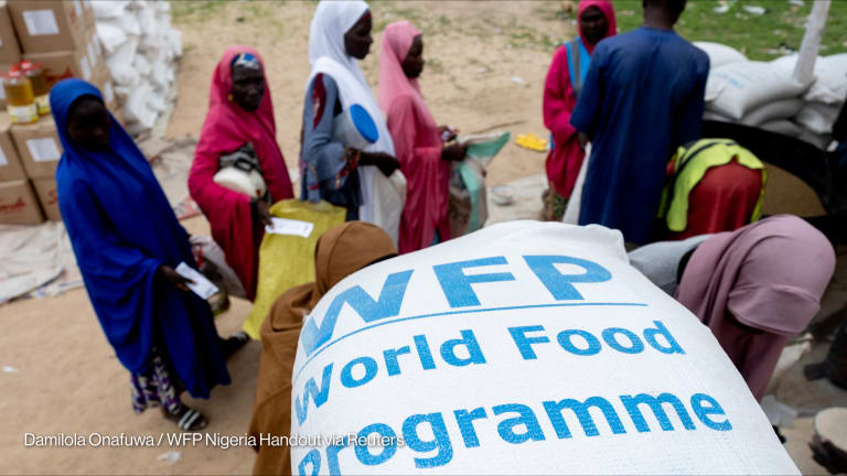
In-depth data will help WFP to scale its programming to meet the needs of 90,000 people identified from the pilot, Kamara said. That mostly involves food vouchers or cash transfers, with in-kind distribution being a rarity reserved for when markets are not functioning or food prices are too high.
Boudinaud said WFP plans to extend its use of satellite data analysis outside Mali, with pilots in northern Burkina Faso, western Niger, and other areas of the Sahel that are inaccessible on the ground. The organization is also considering how the data could be useful in examining pastoral livelihoods, droughts, and flood monitoring.
“It’s a real success because we managed to use the technology for the response to help people but also to show that technology can be useful in Mali,” Kamara said. “It’s not always easy to know what kind of innovations exist on the market, how you can use them, and how they can meet your needs and objectives.”
About the author

Teresa Welshtmawelsh
Teresa Welsh is a Senior Reporter at Devex. She has reported from more than 10 countries and is currently based in Washington, D.C. Her coverage focuses on Latin America; U.S. foreign assistance policy; fragile states; food systems and nutrition; and refugees and migration. Prior to joining Devex, Teresa worked at McClatchy's Washington Bureau and covered foreign affairs for U.S. News and World Report. She was a reporter in Colombia, where she previously lived teaching English. Teresa earned bachelor of arts degrees in journalism and Latin American studies from the University of Wisconsin.