NAIROBI — Climate change is expected to increase water scarcity in Africa. Already, 1 in 3 people in Africa face water scarcity and about 400 million lack access to safe drinking water.
How user-friendly satellite data could revolutionize development
Thanks to advances in technology, satellite imagery is more accessible than ever. Here’s how the development community can benefit from analysis-ready data.
To further exacerbate this, many African countries don’t have the tools at hand to properly manage their water supplies. Noncomprehensive datasets make it difficult to know how much is coming in through rainfall and how much is washed away. This prevents certain governments from properly managing the supplies they have.
“One of the big challenges of dealing with water resource management is: How are you going to manage something if you can't measure it?” said William Rex, senior adviser at the International Water Management Institute.
Satellite imagery offers a potential solution for better management. A new partnership launched on Thursday between IWMI and Digital Earth Africa aims to create easy to interpret data sets for governments, and others, to make more informed decisions about how to allocate water. The $3 million partnership is funded by the Leona M. and Harry B. Helmsley Charitable Trust and is expected to run for three years.
“One of the big challenges of dealing with water resource management is: How are you going to manage something if you can't measure it?”
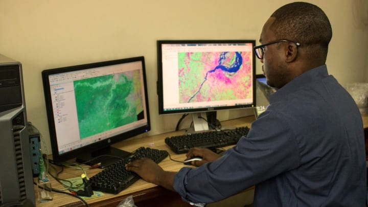
— William Rex, senior adviser, International Water Management InstituteEarth observation satellites are routinely collecting data on the continent, through agencies such as the U.S. National Aeronautics and Space Administration or the European Space Agency, including data on water resources.
But accessing that data is not always easy, Rex said. This includes a lack of widespread awareness of the datasets that already exist within governments across the African continent, as well as the technical challenges around downloading and processing the data, he said. Even when the images are free, they become relatively expensive to clean up.
“In Africa, across many countries on a day-to-day basis, this sort of data is in practice not used or not readily available,” he said.
Digital Earth Africa is already organizing decades of this satellite data into an open data cube for the African continent, collecting satellite images into a stored space and cleaning it up, with an aim to make analysis-ready data. It launched late last year and already has a prototype cube.
“They've created the infrastructure that makes it a lot simpler for anyone who's trying to use satellite imagery of Africa to access that data by removing those sorts of preprocessing steps that are necessary,” Rex said.
But to make it more accessible, software needs to be developed to help policymakers make decisions about specific problems, he added.
The partnership between IWMI and Digital Earth Africa focuses on developing software that runs a computer to provide a better picture of water resources in a specific area. This includes flood mapping, drought forecasting, and helping governments better understand how much water is in basins or catchment areas.
“How should countries manage scarce water resources is fundamentally a question about trade-offs. But if you're going to manage trade-offs, you need to know how much water you've got and how much is being used for different applications,” Rex said.
This information could help governments decide how much they can sustainably extract for an irrigation scheme, for example.
To get this software into the hands of decision-makers, the partnership has committed to working with the African Ministers' Council on Water and is in discussions with the African Network of Basin Organization. After the applications are developed, the partnership will also work with specific governments on rolling them out, including training on the software.
The first software application will focus on flood mapping, which looks at where water flows when there is excessive rain. According to Rex, while some countries have fairly good flood mapping at a national level, this data can provide more comprehensive regional maps — given the transboundary nature of many waterways. This application could be operational in the next 18 months — and into the hands of national and basin authorities, for free, as well as eventually farmers.
The other software applications will focus on drought forecasting, looking at areas such as vegetation coverage and soil moisture, and water accounting. The Intergovernmental Panel on Climate Change predicts that droughts in East and Southern Africa will intensify due to climate change, creating stress on water supplies and threatening food security. Taking a look at questions such as how much water is gained during rainfall, as well as how much is used in agriculture and industry, these other applications could be operational in the next two years.
One of the challenges in bringing these software applications to scale is that linking ground-level data to complement the satellite data helps to train the technical algorithms to improve over time, improving the quality of the data. This includes physical measurement of rainfall, streamflow, soil moisture, and water quality.
For example, satellite-based rainfall measurement methods would be tested and “trained” against actual rainfall data for an area generated from rain gauges, which is usually managed by a nation’s hydrometeorological department, Rex said.
Ensuring there is increased cooperation across governments in data sharing is key moving forward, he said.
Visit the Data for Development series for more coverage on practical ways that satellite data can be harnessed to support the work of development professionals and aid workers. You can join the conversation using the hashtag #DataForDev.
About the author

Sara Jervingsarajerving
Sara Jerving is a Senior Reporter at Devex, where she covers global health. Her work has appeared in The New York Times, the Los Angeles Times, The Wall Street Journal, VICE News, and Bloomberg News among others. Sara holds a master's degree from Columbia University Graduate School of Journalism where she was a Lorana Sullivan fellow. She was a finalist for One World Media's Digital Media Award in 2021; a finalist for the Livingston Award for Young Journalists in 2018; and she was part of a VICE News Tonight on HBO team that received an Emmy nomination in 2018. She received the Philip Greer Memorial Award from Columbia University Graduate School of Journalism in 2014.